Zonnebeke
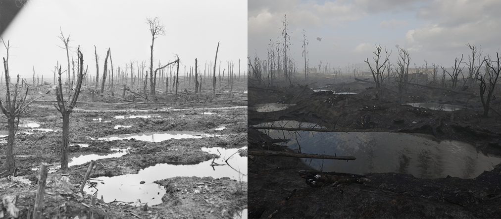
Zonnebeke was our first attempt at creating a map that provides compelling combat zones for a shooter that emphasizes bolt-action gunplay and melee mechanics. We decided that the flooded countryside of Belgium, blown apart by shelling, was an excellent start point for exploring how to create compelling trench warfare.
Pre-Production
Before we began the creation of Zonnebeke, we asked ourselves a series of questions.
- How big should our maps be?
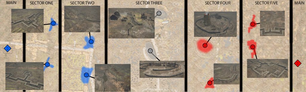
- How many points of interest should be placed across them?
- How can we use crates, barrels, and other forms of logistical supplies to create combat zones that offer cover while also looking like it belongs in the environment?
- How will you make the gunplay, which was imported from Squad, feel compelling when players are only moving either forward or backwards across the trench lines?
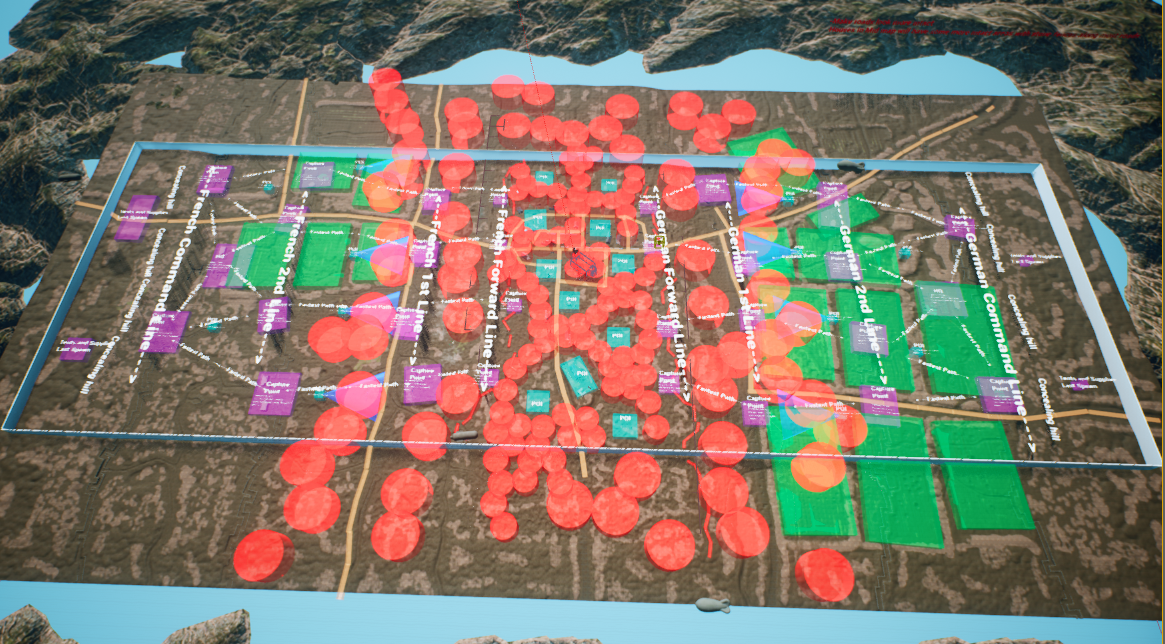
Many of the developers came from Squad, and we quickly learned that the scale of Squad maps would not work for a game with close-quarters combat as Beyond The Wire. We set our initial dimensions to 1,200 by 800 Unreal units. Then we decided to create a mirrored map similar to 2Fort from Team Fortress Two. This format allowed us to create a minimum viable product for our initial playtests quickly.
Initial Reception
Our initial playtests revealed that our trenches didn’t feel authentic enough and that our no man’s land was far too empty. Players also complained about a lack of pathways from the frontline trenches to the center of the map. To remedy these issues, we blocked out plans for another revision that added a significant amount of craters throughout the level. We also added several burnt forests that served as minor points of interest. Players could take shelter within these forests and set up mobile spawn points.
Revisions to geographic features
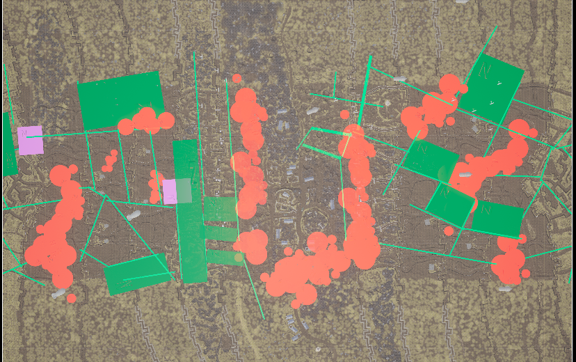
Subsequent playtests revealed that combat within our trench networks was beginning to meet player expectations. However, the ground above the trenches continued to feel vast and empty. This was due to scaling levels based on real-world proportions. Specifically, we sculpted hedgerows and other partitions of farmland at too large of a scale. After some brainstorming, we decided the best approach would be to block out another revision of hedgerows at a smaller scale constructed from photo reference to help break up lines of sight and provide a space for level designers to create additional minor points of interest.
Final touches
Playtesting demonstrated that the scaling down of hedgerows provided the level with enough line of sight blockers to partition the combat spaces into medium & short-range combat spaces. During this phase, we constructed additional pathways throughout the village in the center of the map. Our final challenge was flooding the remaining spaces and sculpting the terrain to convince players that these areas have seen consistent shelling for several years. To achieve this, we applied a paint layer to our landscape to create a mask that contained all the open sections of the field. A heightmap was then exported and brought into photoshop. A cloud filter was then applied across the map using the mask to ensure that only the open spaces would be affected. I then imported the result back into the level resulting in a topology that resembled the battlefields of the first world war.